Community Forms


May 22, 2021 – ongoing
Matt Barton was a 2021 Black Cube Artist Fellow. This project is an outdoor, permanent, sculptural installation that encourages freeform interaction, creative play, and exploration. In addition to its playful use, Barton’s abstract forms also serve as a novel solution for flood mitigation. Community Forms is permanent and always open.
Community Forms
Matt Barton
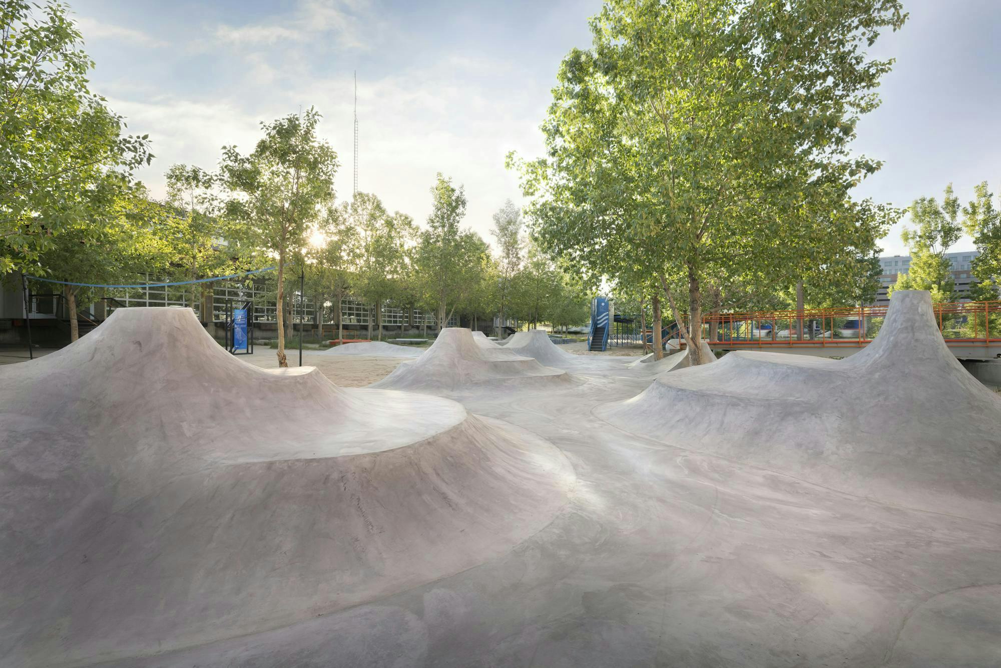
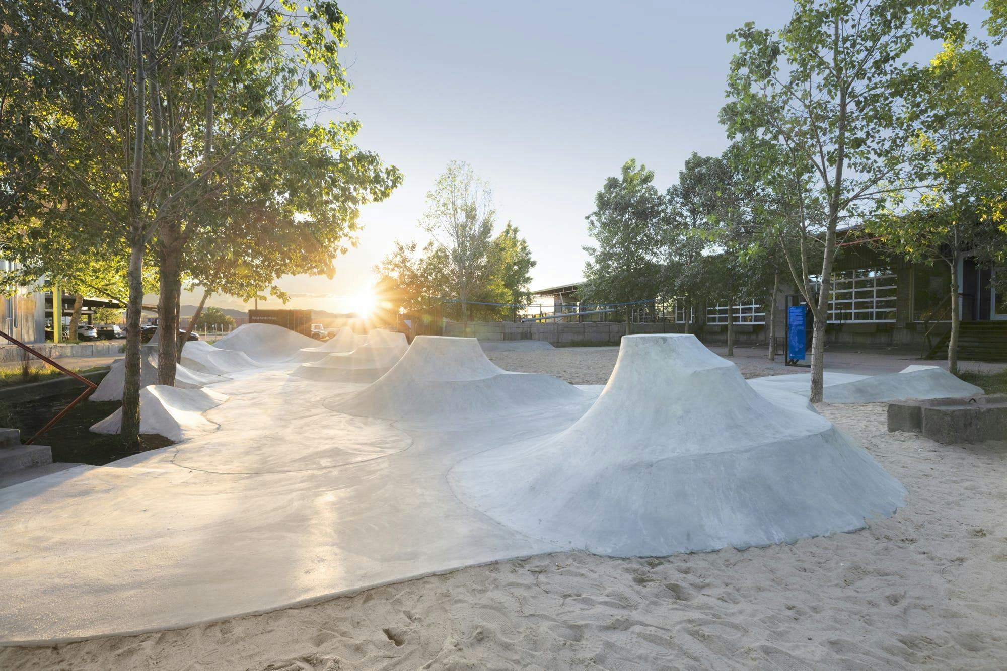
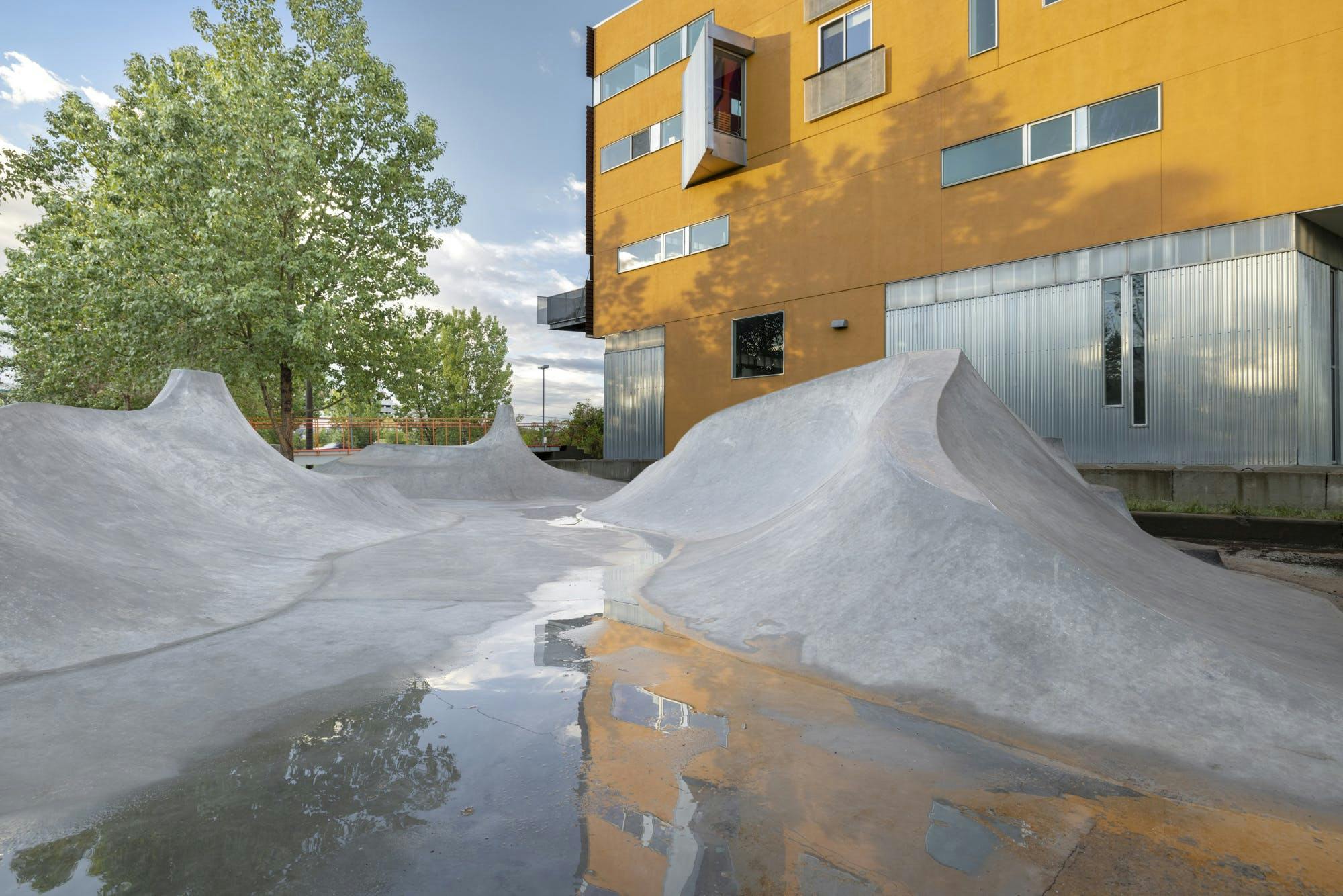
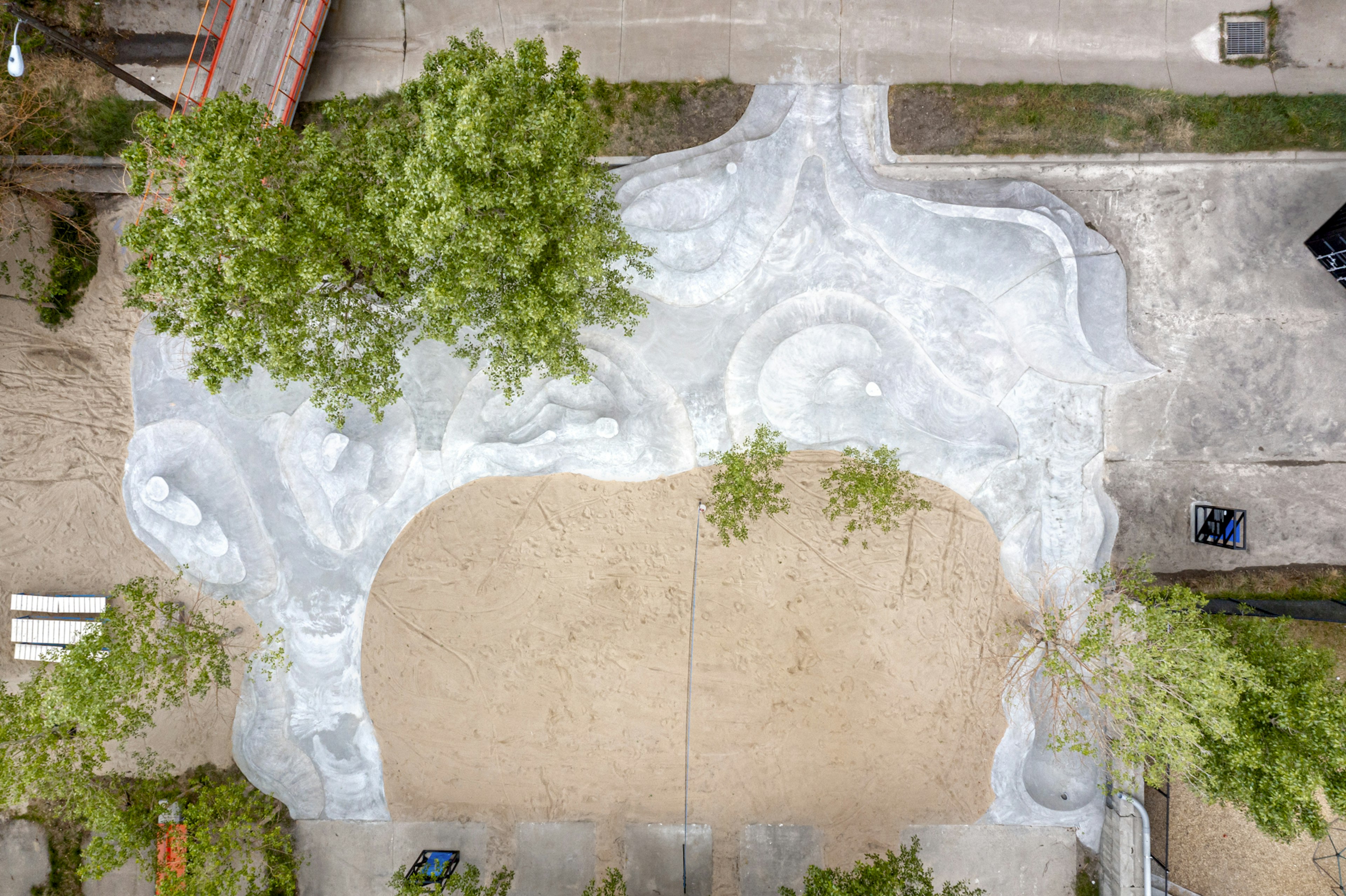
Part rainwater drainage system, part recreational space, Community Forms by Black Cube Artist Fellow Matt Barton is an outdoor site-specific art installation designed for a mixed-use community space within Denver’s Globeville neighborhood. Located adjacent to Colorado’s South Platte River, Barton’s sculptural intervention features abstract curvilinear forms that provide a social space for gathering and creative play and also channel stormwater. Barton drew inspiration from the existing site and innovative developments in urban design and landscape architecture to create sculptures that guide the natural waterflow into nearby bioswales—vegetated ditches that aid in the collection, conveyance, and filtration of stormwater. Composed of concrete, formed earth, and landscaping materials, the artwork visually references skateparks and disciplines such as Land and Earth art. Community Forms encourages non-prescriptive, freeform, exploratory interaction through dynamic visitor-centric sculptures that collectively generate a welcoming public space and a novel solution to flood mitigation.
About the Site
Located on the repurposed 25-acre former Yellow Cab site, the TAXI community is a work-live development. The mixed-use community occupies nine buildings, which includes more than 150 workspaces and 300 full-time residents. Adjacent to the South Platte River in the Globeville neighborhood, the TAXI campus has a repurposed industrial design appearance and also incorporates native landscaping that double as storm-water management systems. Amenities on the campus include a restaurant, café, early childhood education center, community garden, swimming pool, and more. This diverse community continues to grow by focusing on new structures and features for the campus such as Matt Barton’s Community Forms, which facilitate partnerships and collaboration.
Why should we think about flood mitigation?
Winter snowfall and rain from summer storms flow down from the Colorado mountains into rivers along the Front Range. In some years, snow melt and intense storms may channel more water into these rivers than their banks can contain. When stormwater flows into the built environment, structures and people may be put at risk.
Denver’s most damaging flood happened in June 1965, when 15 inches of rain caused a 20-foot wall of debris-filled water to flow down the South Platte River, resulting in over 300 million dollars’ worth of damages and the deaths of two Globeville residents. In response, dams were constructed upstream, greatly reducing (but not removing) Denver’s risk of major flooding.
In a natural floodplain the vegetated areas alongside rivers and streams help to absorb and slow down flood waters. The shape of Community Forms and the location of planted areas on this campus help to temporarily store water flows, giving them a chance to soak into the soil and slowly drain into the nearby river.
Flood maps show which areas are prone to flooding. Visit www.fema.gov/flood-maps to learn more.